
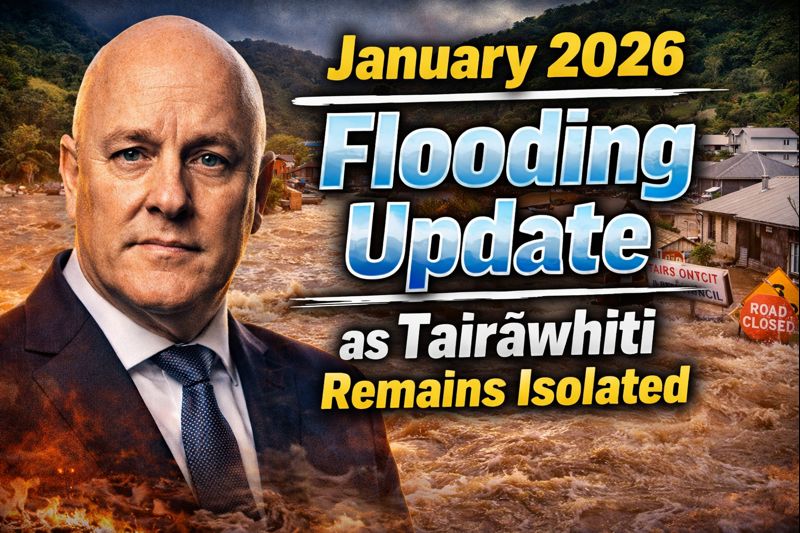
Torrential rains and relentless storms have ravaged New Zealand’s North Island throughout mid-January 2026, triggering widespread flooding, landslides, and extensive road closures that have severed communities. Tairāwhiti, encompassing Gisborne and surrounding districts, stands as the hardest hit, with key routes like State Highway 2 through Waioweka Gorge blocked by massive slips, leaving the region cut off from the rest of the country. As cleanup efforts intensify on January 23, emergency agencies warn of ongoing risks, urging residents to prepare for prolonged isolation amid saturated soils and swollen rivers.
Storm Timeline
The deluge began intensifying on January 16, when heavy downpours assaulted the east coast, saturating catchments from Northland to the Bay of Plenty. Waioweka Gorge saw the first major landslide, trapping vehicles and prompting overnight helicopter rescues for dozens of stranded motorists. By January 18, Northland’s Whangarei District faced severe flooding, closing local roads south of Kawakawa and in the Far North.
States of emergency rolled out preemptively: Whangarei on January 20 ahead of another rain bomb, followed by Thames-Coromandel on January 21 as rivers burst banks. January 22 brought fresh tragedy—landslides at Mount Maunganui and Papamoa claimed lives and left others missing—while Coromandel roads crumbled under the onslaught. MetService’s alerts painted a grim picture: over 300mm fell in Tairāwhiti in 72 hours, shattering records and fueling a cascade of disruptions.
Even as skies offered brief respite by January 23, NEMA cautioned that dangers persist, with ground saturation heightening slip risks for days.
Key Road Closures
State Highway 2 forms the backbone of east coast travel, but Waioweka Gorge’s closure between Mātāwai and Waioweka has isolated Tairāwhiti entirely. Massive earthfalls buried sections under meters of debris, with no detour viable due to terrain. NZTA crews work around the clock, but engineers deem the site too unstable for heavy machinery.
Thames-Coromandel fares little better: SH25 remains shut from Hikuai to Tairua and Whitianga to Tairua, stranding beach towns. SH25 Whiritoa to Waihi and SH25A Kopu to Hikuai have reopened sporadically, but SH2 Karangahake Gorge between Paeroa and Waihi lingers closed. Northland’s local roads—dozens in Whangarei and south of Kawakawa—stay impassable, though state highways cleared for essential traffic.
Taranaki’s SH3 faces a planned five-day shutdown from January 16-20 near Ahititi for culvert repairs, extended by weather, adding 40-60 minutes to detours via SH1 or SH4. Bay of Plenty slips compound woes, with secondary roads like those to Welcome Bay blocked.
| Region | Closed Roads | Status | Detours Available |
|---|---|---|---|
| Tairāwhiti | SH2 Waioweka Gorge (Mātāwai-Waioweka) | Fully blocked, high risk | None |
| Thames-Coromandel | SH25 Hikuai-Tairua, Whitianga-Tairua | Closed, partial reopenings | Via SH2 (limited) |
| Northland | Local roads Whangarei, Kawakawa | Many open, locals only | SH1/SH10 |
| Bay of Plenty | SH2 Papamoa, local slips | Assessing | SH29 alternate |
| Taranaki | SH3 Ahititi-Uruti | Planned closure extended | SH1/SH4 |
This table captures primary closures as of January 23, subject to hourly changes.
Tairāwhiti Isolation Impacts
Gisborne and East Coast bear the brunt, with no land access since January 16. Supplies airlifted via helicopters strain logistics; supermarkets ration essentials, and fuel queues snake through towns. Schools shuttered, hospitals divert ambulances, and marae step up as welfare centers, sheltering hundreds.
Economic fallout hits hard: kiwifruit orchards flood, delaying harvest; tourism grinds to halt with motels empty. Iwi leaders coordinate with Civil Defence, invoking tikanga for rationing and mental health support. Power flickers for thousands, while cell towers falter in remote spots.
Residents recount harrowing tales—families winched from rooftops, farmers herding livestock to high ground. Isolation fosters self-reliance, but whispers of cabin fever grow as the long weekend looms.
Rescue and Recovery Efforts
NZTA deploys excavators and Bailey bridges, prioritizing life-saving access. Helicopters from the Defence Force ferry aid, dropping water pallets and medical teams. In Waioweka, geotech specialists map slip zones via drones, halting work during aftershocks.
Civil Defence volunteers—thousands strong—muck out homes, distribute sandbags, and man checkpoints. NEMA’s national controller warns against sightseers, citing blocked emergency routes. Police search for flood-swept individuals, recovering two bodies from Papamoa slips while six remain missing at Mount Maunganui.
Restoration timelines stretch weeks: SH2 might reopen partially by late January, but full clearance eyes February. Backup dates for Taranaki’s SH3 shift to January 23-27, weather permitting.
Weather and Geological Factors
This storm—a “weather bomb” fusing ex-tropical moisture with polar fronts—dumped biblical rains, with Tairāwhiti’s 300mm rivaling cyclones. Warmer Tasman Sea temperatures supercharged it, per MetService, aligning with climate models predicting 25% wetter extremes by 2050.
Steeper terrain amplifies slips: Waioweka’s narrow gorge funnels runoff, while Coromandel’s volcanic soils turn to sludge. Deforested hillsides worsen erosion, a post-Cyclone Gabrielle legacy. Rivers like the Wairoa and Thames swelled 5-7 meters, breaching stops.
Forecasts signal easing by January 24, but isolated showers linger, keeping soils primed.
Community and Economic Toll
Northland businesses urge tourists away, with flooded cafes boarding windows. Thames-Coromandel’s holiday parks empty, costing millions in lost revenue. Tairāwhiti farmers face crop ruin—maize fields submerged, sheep drowned—projecting $50 million agricultural losses.
Marae networks shine: Ngāti Porou and Te Aitanga a Mahaki host evacuees, blending emergency aid with kai moana feasts. Schools pivot to online learning where signals allow, while mental health lines buzz.
Government pledges $20 million initial relief, fast-tracking welfare payments. Insurers brace for 10,000 claims, echoing 2023’s $2 billion payout.
Government Response
Prime Minister Christopher Luxon toured Coromandel, vowing infrastructure overhauls. Transport Minister Simeon Brown allocates $100 million for resilience—elevated bridges, slip-resistant paving. Emergency Management Minister Mark Mitchell coordinates from Wellington, linking NEMA with iwi.
States of local emergency persist in five districts, unlocking powers for requisitions. Air bridges to Gisborne prioritize food, meds, and builders. Opposition parties push for climate adaptation fund, critiquing slow rural broadband exposing isolations.
Lessons from Past Events
January 2026 echoes Cyclone Gabrielle’s 2023 fury, which closed SH2 for months and cost $14 billion. Then, Waioweka slips stranded 200; now, lessons like drone surveys and prepositioned diggers expedite response. Northland’s 2023 floods honed flood walls, yet overload exposed gaps.
Stats reveal trends: North Island slips up 30% since 2010, tied to wetter La Niña phases. Post-Gabrielle audits flagged 500 vulnerable spots; this storm hit half.
Safety Advice for Travelers
Avoid non-essential travel—check journeys.nzta.govt.nz hourly. Stock 72-hour kits: water, radios, maps. Locals clear culverts, report hazards via 0800 apps. Never drive floods; two meters sweeps cars away.
Farmers secure stock early; households elevate valuables. Communities form neighborhood watches, sharing generators.
Looking Ahead
Reopenings trickle: Karangahake by evening January 23, Hikuai access soon after. Tairāwhiti eyes partial SH2 by week’s end, full by February. Long-term, $1 billion national roads package targets east coast.
Resilience builds: community bonds tighten, infrastructure hardens. As waters recede, Aotearoa confronts a wetter future, one cleared path at a time.

Lance Evans is a contributor at CSKHYBER.co.nz covering New Zealand and Australia news, with a focus on trending updates and public-interest stories.